Hiking Trails
More than 600 km of marked trails for all levels
Network of Hiking Trails
The High Tatras offer an extensive network of marked trails for tourists of all levels
Tatra Trail
The most beautiful long-distance hiking trail in the Carpathians
Crossing the High Tatras on the Main Trail
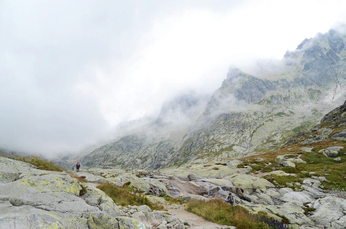
The most famous hiking trail in the Tatras. The Tatra Trail is a red- marked trail that crosses all southern valleys of the High Tatras. The High Tatra section measures 46 km with a total elevation of 4,800 m (2,800 m ascent, 2,000 m descent).
Route: The trail starts at Podbanské and leads via Tri studničky, Jamské Lake, Štrbské Lake, bypasses Poprad Lake, passes the Symbolic Cemetery and Sliezsky Dom, continues to Malá Studená Valley via Hrebienok and ends in Tatranská Javorina.
Division into stages:
- Stage 1: Podbanské - Tri studničky - Štrbské Lake (12 km, 5-6 h)
- Stage 2: Štrbské Lake - Poprad Lake - Sliezsky Dom (14 km, 6-7 h)
- Stage 3: Sliezsky Dom - Hrebienok - Tatranská Lomnica (10 km, 5-6 h)
- Stage 4: Tatranská Lomnica - Tatranská Javorina (10 km, 4-5 h)
Most beautiful sections: Obrovský Waterfall in Studená Valley, views from Lomnická Viewpoint, surroundings of Poprad Lake and section along Štrbské Lake with views of Solisko and Furkotské Peaks.
Accommodation: Along the route are mountain chalets where you can stay overnight. Advance reservation is mandatory, especially in high season. Between chalets: Captain Morávka Chalet, Poprad Lake, Sliezsky Dom, Zamkovského Chalet, Bilíkova Chalet.
Easy Trails (suitable for families)
Undemanding walks with beautiful views
Štrbské Lake - Circuit
Beautiful walk around Štrbské Lake. Asphalt trail suitable even for strollers. Wonderful views of surrounding peaks, information boards about nature and history of the area. Possibility of refreshments in several establishments.
Studený Stream - Waterfall
From Starý Smokovec to Obrovský Waterfall. Trail climbs comfortably through forest with views of the waterfall. 15 meters high, among the most beautiful in the Tatras. Suitable for all age groups.
Hrebienok - Circuit
From Hrebienok (accessible by cable car) circuit via Bilíkova Chalet. Beautiful views of Slavkovský Peak and Tatra valleys. Possibility to see marmots, in winter excellently maintained winter trails.
Poprad Lake - Circuit
Around Poprad Lake leads a comfortable trail. One of the largest Tatra lakes with beautiful reflection of Mengusovské Peaks. Possibility to continue to Symbolic Cemetery.
Moderately Difficult Trails
For experienced tourists with good fitness
Hrebienok - Zamkovského - Téry Chalet
Classic route through Malá Studená Valley. Beautiful views of waterfalls, forest sections and gradually revealing high-mountain environment. Destination at Five Spis Lakes. Possibility of overnight stay at Téry Chalet.
Hrebienok - Zbojnícka Chalet
Through Veľká Studená Valley to the chalet. You pass by Veľký Studenovodský Waterfall, gradually climbing into high-mountain environment. Around the chalet 26 Tatra lakes! Possibility to continue to individual lakes.
Štrbské Lake - Poprad Lake
Section of Tatra Trail through the Symbolic Cemetery area. Gradually climbing to Poprad Lake with views of Mengusovské Peaks. Possibility to continue to Sliezsky Dom.
Tatranská Lomnica - Zelené Lake
Pleasant hike through dense forest to one of the most beautiful Tatra lakes. Zelené Lake has emerald-colored water. At the lake is a chalet with refreshments. Excellent view of Jastrabie Veže.
Difficult Ascents
For experienced tourists with excellent fitness
Tri studničky - Kriváň
Ascent to the national symbol of Slovakia. Climbing via Štôlsky Ridge into alpine environment. Last sections are rocky and exposed. Requires good fitness, confidence in exposed terrain and suitable weather. Unforgettable views from the summit!
Štrbské Lake - Rysy
Highest peak accessible without a mountain guide. Ascent leads via Poprad Lake, Žabie Mengusovské Lakes and Chalet pod Rysmi. Summit on Slovak-Polish border. Requires experience, good fitness and early start.
Hrebienok - Sedlo pod Ostrvou
Ascent to saddle with breathtaking views of Mengusovská Valley and Lomnický Peak. Route leads via Skalnaté Lake, then steeply climbs to the saddle. Exposed sections, chains for securing. For experienced tourists.
Téry Chalet - Sedlo Váha
From Téry Chalet to saddle with fantastic views to Poland. Steep climb through rocky terrain with chains. From saddle views of Polish Tatras, Morskie Oko and main ridge. Only for experienced!
Tatra Valleys
Each valley has its unique character
Malá Studená Valley
Most visited valley with Obrovský Waterfall, Zamkovského Chalet, Téry Chalet and Five Spis Lakes. Excellent views of Lomnický Peak and main ridge.
Veľká Studená Valley
Valley with the largest number of lakes (26). Leads to Zbojnícka Chalet and further to high-mountain lakes. Beautiful views of Lomnický and Ľadový Peaks.
Mengusovská Valley
Wilder valley with Poprad Lake and Symbolic Cemetery. Views of Mengusovské Peaks and Široká Veža. Fewer tourists, more peaceful atmosphere.
Furkotská Valley
Short but beautiful valley at Štrbské Lake. Leads to Furkotské Lakes with breathtaking view of Furkotské Peaks and Solisko. Popular full-day hike.
Mlynická Valley
Entry gate to Rysy. Valley with cascading lakes - Žabie Mengusovské Lakes. Base for ascents to Rysy and surrounding peaks.
Javorová Valley
Eastern valley at Tatranská Javorina. Less known, offers more peaceful hiking. Views of Javorové Peaks and access to Jarové Lakes.
Hiking Trail Marking
🔴 Red Mark
Main long-distance trails including the Tatra Trail. Connect important points and cross the entire mountain range. Most important trails in the Tatras.
🔵 Blue Mark
Secondary trails, often connecting valleys or leading to chalets and significant places. Important connections between main trails.
🟢 Green Mark
Access trails from towns and villages to valleys. Usually lead from lower altitudes to the beginnings of main hiking trails.
🟡 Yellow Mark
Shorter local trails, circuits or connectors. Often lead to local attractions or create circuits in combination with other trails.